Updated
← Back to mapCalifornia Rivers › Redding to Bend, Northern California
The big tailwater below Keswick Dam, from the town trails in Redding to the drift-boat riffles past Anderson and the volcanic water at Bend.
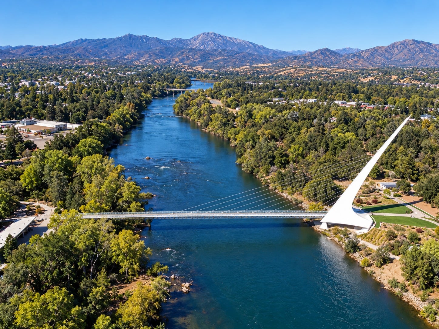
The Lower Sac is the Sacramento River below Shasta Dam and Keswick Dam, a big, cold tailwater that runs south through Redding and Anderson and on down to Bend. Releases from the dams set the level, and many spots change with it. The river is wide and heavy almost everywhere, broken up by long riffles, glides, tailouts and gravel bars, with islands, side channels and deep holes in between. The top section runs from Keswick Dam down to Caldwell Park in Redding, with the paved Sacramento River Trail on both banks: small pocket beaches for the first 1.5 miles above the park, rockier and gentler shoreline past that, and deep holes up toward the dam. Through town, from Caldwell Park past the A.C.I.D. irrigation dam, Posse Park and Turtle Bay to the Cypress St and Bonnyview bridges, the river is broad and deep, and low water uncovers gravel bars and riffles you can wade. Below Redding, Clear Creek joins near Cascade Park and the river slides past Kapusta to Anderson River Park, where a long gravel bar gives bank anglers room. From Anderson past the Deschutes Bridge, Cow Creek, Balls Ferry, Reading Island and Cottonwood Creek, this is drift-boat water, and some riffles are reachable only by boat. Battle Creek joins near Coleman Fish Hatchery, and from Jellys Ferry to Bend the river cuts through old volcanic flows that make natural casting platforms, with Perrys Riffle, Massacre Flat and Inks Creek reached by long walks. In 1992 there were launch ramps at Caldwell Park, Posse Park, Bonnyview, Anderson River Park, Balls Ferry, Reading Island, Jellys Ferry and Bend Bridge; confirm a ramp is open before you tow a boat there. No run months are given here. Salmon spawn in the riffles, and Posse Park, Cascade Park and the Battle Creek bridge are good places to watch them. Steelhead hold in the riffles and glides at Kapusta and run up Battle Creek, which fishes well from the bank and better wading. Trout spread through the riffles all the way down to Massacre Flat, and bass sit in the lee of islands, in backwaters and ponds, and in the side channel behind Reading Island. Bank anglers drift bait and lures from pocket beaches, gravel shores and rock outcrops in the deep, even water. Fly anglers do best wading the riffles at low water, when the bars are exposed; a glo bug is the standard at Kapusta, and dry flies work in the volcanic water between Jellys Ferry and Bend. High water spreads into a broad, even flow over many wading spots, and the cobble can be slick with moss, so wade with care. A boat opens up riffles walkers cannot reach, including Cow Creek Riffle and the water below Inks Creek. Parts of the river are closed to salmon fishing; check CDFW's current regulations. Rules change from year to year and differ by section, so read the current California regulations before you go.
Best Season
Low water, when the gravel bars and wadeable riffles open up
River Type
Big tailwater with riffles, glides, gravel bars and deep holes
Skill Level
Intermediate: big, deep water and slick cobble
Best Techniques
Wading the riffles with flies, drifting bait and lures from the bank, fishing from a drift boat
Access
City parks, trails and bridges give walk-in access through Redding and Anderson; below that the bank spots thin out and a boat covers more water.
Explore fish species associated with the The Lower Sac. Each profile includes identification tips, habitat notes, and practical fishing guidance for anglers.
Review seasonal insect hatches on the The Lower Sac, including timing windows and fly pattern suggestions for your next trip.
Check current seasons, limits, and special rules for The Lower Sac before you go. Regulations change, so always verify with IDFG.
The latest fishing conditions and hatch notes for The Lower Sac. Older reports live in the The Lower Sac report archive.
These YouTube videos have been hand-curated by our team because we feel they best represent the The Lower Sac fishery. Watch for river character, access context, and techniques that translate to your next trip.
No towns within 30 mi
Map data © Mapbox © OpenStreetMap
Part of Sacramento River (whole river)
Fishing guides, outfitters, shuttles, and shops that operate on the The Lower Sac.
No verified providers for this river yet. Browse the full directory.
These YouTube videos have been hand-curated by our team because we feel they best represent the The Lower Sac fishery. Watch for river character, access context, and techniques that translate to your next trip.
Review seasonal insect hatches on the The Lower Sac, including timing windows and fly pattern suggestions for your next trip.
No data for this season.