Updated
← Back to mapCalifornia Rivers › Lake Almanor, Northern California
A small, brushy trout stream of pools, whitewater riffles and small falls between Mountain Meadows Reservoir and Lake Almanor.
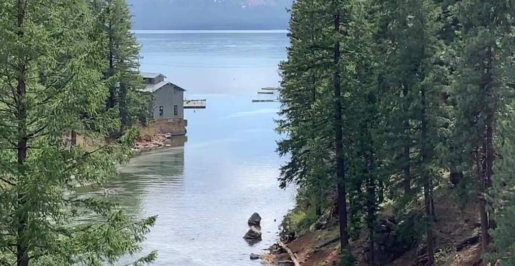
Hamilton Branch is a small trout stream that links Mountain Meadows Reservoir to Lake Almanor. It leaves the reservoir at Indian Ole Dam, picks up Clear Creek, cuts a short canyon between Mary Ann Lane and Highway 147, and meets the lake at the community of Hamilton Branch. It is pocket-sized water: pools, whitewater riffles and small falls, with brushy banks along much of it and a stretch of meadow above Clear Creek. The top of the stream is the water below Indian Ole Dam, reached off Road A-21. In 1990 this was day-use ground with plenty of parking along the road to the dam, and the pools, riffles and little falls here are as pretty as anywhere on the creek. A little farther down, a bridge crosses the stream on a road shared with logging trucks; in 1990 that bridge was gated and could be locked, but you could climb down to the water along the road or at the crossing. Near Clear Creek, 1.6 miles off Highway 36, a pool and steep stepped riffles sit at the road, and above them the stream winds through meadow with pools and grassy cover. Below Clear Creek the stream enters its canyon. Mary Ann Lane leaves Road A-13 and gets rough, and in 1990 it was 4x4 only past 1.3 miles; you park and walk through the woods to many pools and whitewater riffles. The east side, off Highway 147, is the easier approach, with a turnout and a dirt road to a rough camp near the Highway 147 bridge. The last access is a bridge close to Lake Almanor, with a steep path down from its northeast side. The fish are trout. No month-by-month timing is known for this stream. This is short-rod water. Wade where you can, since the brush crowds the banks, or fish from rocks above the pools. Fly anglers do well working upstream through the meadow above Clear Creek; bait and small lures fit the deeper pools in the canyon. Regulations change and differ by section, so check the current California regulations before you go.
Best Season
The open trout season
River Type
Small stream with pools, whitewater riffles, small falls and a meadow stretch
Skill Level
Intermediate; brushy banks and steep paths
Best Techniques
Wading upstream with a short fly rod, bait and small lures in the pools
Access
Short walks from turnouts, dirt roads and bridges off Highway 147 and Roads A-13 and A-21 reach the stream.
Explore fish species associated with the Hamilton Branch. Each profile includes identification tips, habitat notes, and practical fishing guidance for anglers.
Review seasonal insect hatches on the Hamilton Branch, including timing windows and fly pattern suggestions for your next trip.
Check current seasons, limits, and special rules for Hamilton Branch before you go. Regulations change, so always verify with IDFG.
The latest fishing conditions and hatch notes for Hamilton Branch. Older reports live in the Hamilton Branch report archive.
These YouTube videos have been hand-curated by our team because we feel they best represent the Hamilton Branch fishery. Watch for river character, access context, and techniques that translate to your next trip.
No towns within 30 mi
Map data © Mapbox © OpenStreetMap
The latest fishing conditions and hatch notes for Hamilton Branch. Older reports live in the Hamilton Branch report archive.
Hamilton Branch is flowing steady with mostly green water and active fish feeding on pond smelt. Shore anglers should focus on smelt patterns while watching for occasional muddy pushes during flow spikes.
These YouTube videos have been hand-curated by our team because we feel they best represent the Hamilton Branch fishery. Watch for river character, access context, and techniques that translate to your next trip.
Fishing guides, outfitters, shuttles, and shops that operate on the Hamilton Branch.
No verified providers for this river yet. Browse the full directory.
Review seasonal insect hatches on the Hamilton Branch, including timing windows and fly pattern suggestions for your next trip.
No data for this season.